Wath Mill, Nidderdale
Introduction
The photograph on this page of Wath Mill, Nidderdale by Alan Murray-Rust as part of the Geograph project.
The Geograph project started in 2005 with the aim of publishing, organising and preserving representative images for every square kilometre of Great Britain, Ireland and the Isle of Man.

There are currently over 7.5m images from over 14,400 individuals and you can help contribute to the project by visiting https://www.geograph.org.uk
Wath Mill, Nidderdale
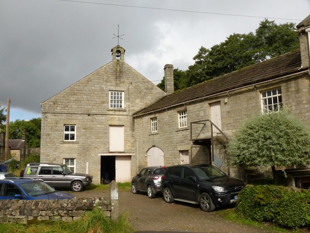
Image: © Alan Murray-Rust Taken: 9 Sep 2017
The main front of the mill. This and the stable range to the right date from around 1818. The bellcote goes back to its original purpose as a flax mill when there would have been a significant workforce employed.
Images are licensed for reuse under creativecommons.org/licenses/by-sa/2.0
Image Location


Leaflet Map data © OpenStreetMap
Latitude
54.10588
Longitude
-1.777895