Flush Bracket OSBM S0581: Heckington, St. Andrew's Church
Introduction
The photograph on this page of Flush Bracket OSBM S0581: Heckington, St. Andrew's Church by Brian Westlake as part of the Geograph project.
The Geograph project started in 2005 with the aim of publishing, organising and preserving representative images for every square kilometre of Great Britain, Ireland and the Isle of Man.

There are currently over 7.5m images from over 14,400 individuals and you can help contribute to the project by visiting https://www.geograph.org.uk
Flush Bracket OSBM S0581: Heckington, St. Andrew's Church
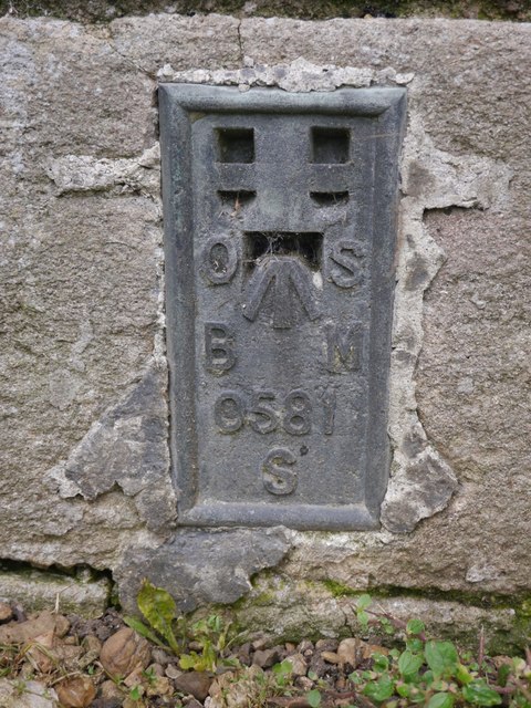
Image: © Brian Westlake Taken: 7 Sep 2017
Flush bracket bench mark that has been fitted over an older cut bench mark. This is on the west face of the tower. See http://www.bench-marks.org.uk/bm16728 for details of the flush bracket, and http://www.bench-marks.org.uk/bm25125 for the older mark.
Images are licensed for reuse under creativecommons.org/licenses/by-sa/2.0
Image Location
Latitude
52.982161
Longitude
-0.299563