Cromwell's Tower, Cromwell Road, Inverness
Introduction
The photograph on this page of Cromwell's Tower, Cromwell Road, Inverness by G Laird as part of the Geograph project.
The Geograph project started in 2005 with the aim of publishing, organising and preserving representative images for every square kilometre of Great Britain, Ireland and the Isle of Man.

There are currently over 7.5m images from over 14,400 individuals and you can help contribute to the project by visiting https://www.geograph.org.uk
Cromwell's Tower, Cromwell Road, Inverness
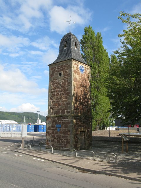
Image: © G Laird Taken: 1 Sep 2017
This clock tower was formerly thought to be all that remains of Cromwell's fort (completed in 1658) in Inverness. The near square-plan red sandstone clock tower is now believed to date from the late 18th century. It is a Category B listed building. https://www.britishlistedbuildings.co.uk/200379726-inverness-cromwell-road-clock-tower-inverness#.WawHhjGWw5s
Images are licensed for reuse under creativecommons.org/licenses/by-sa/2.0
Image Location
Latitude
57.48791
Longitude
-4.229489