Demolition of the Gas Holder
Introduction
The photograph on this page of Demolition of the Gas Holder by Chris Thomas-Atkin as part of the Geograph project.
The Geograph project started in 2005 with the aim of publishing, organising and preserving representative images for every square kilometre of Great Britain, Ireland and the Isle of Man.

There are currently over 7.5m images from over 14,400 individuals and you can help contribute to the project by visiting https://www.geograph.org.uk
Demolition of the Gas Holder
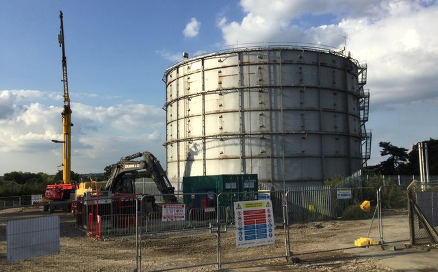
Image: © Chris Thomas-Atkin Taken: 1 Sep 2017
Demolition work has just started on taking down the old Gas Holder by Leylands Road. This is to make way for a Super Store that is being relocated as part of the planned £65m redevelopment of Burgess Hill Town Centre.
Images are licensed for reuse under creativecommons.org/licenses/by-sa/2.0
Image Location
Latitude
50.964156
Longitude
-0.128913