Cayton Bay from the air
Introduction
The photograph on this page of Cayton Bay from the air by Thomas Nugent as part of the Geograph project.
The Geograph project started in 2005 with the aim of publishing, organising and preserving representative images for every square kilometre of Great Britain, Ireland and the Isle of Man.

There are currently over 7.5m images from over 14,400 individuals and you can help contribute to the project by visiting https://www.geograph.org.uk
Cayton Bay from the air
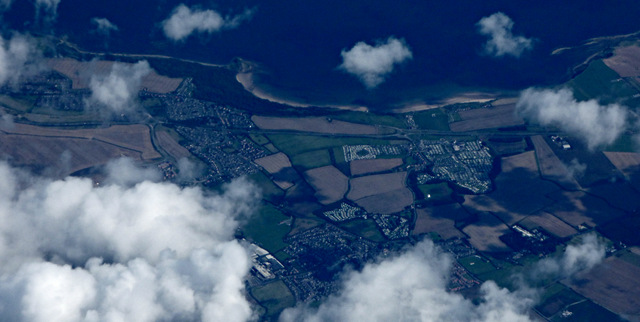
Image: © Thomas Nugent Taken: 18 Aug 2017
The McCains Foods factory https://www.mccain.co.uk/ is just visible between the clouds at the bottom of the photo. Osgodby Point is prominent in the background.
Images are licensed for reuse under creativecommons.org/licenses/by-sa/2.0
Image Location
Latitude
54.236341
Longitude
-0.382828