Llanidloes station, approach 2001
Introduction
The photograph on this page of Llanidloes station, approach 2001 by Ben Brooksbank as part of the Geograph project.
The Geograph project started in 2005 with the aim of publishing, organising and preserving representative images for every square kilometre of Great Britain, Ireland and the Isle of Man.

There are currently over 7.5m images from over 14,400 individuals and you can help contribute to the project by visiting https://www.geograph.org.uk
Llanidloes station, approach 2001
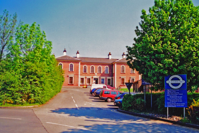
Image: © Ben Brooksbank Taken: 24 May 2001
View east to entrance on Up side: ex-Cambrian Railway Mid-Wales Line, Moat Lane (to left) - (to right) Talyllin Junction - (Brecon). Station and line closed to passengers 31/12/62, goods 4/5/64, but Moat Lane - Llanidloes remained open for goods until 2/10/67. (Cf. Image).
Images are licensed for reuse under creativecommons.org/licenses/by-sa/2.0
Image Location
Latitude
52.447409
Longitude
-3.53474