Waterloo House
Introduction
The photograph on this page of Waterloo House by Keith Edkins as part of the Geograph project.
The Geograph project started in 2005 with the aim of publishing, organising and preserving representative images for every square kilometre of Great Britain, Ireland and the Isle of Man.

There are currently over 7.5m images from over 14,400 individuals and you can help contribute to the project by visiting https://www.geograph.org.uk
Waterloo House
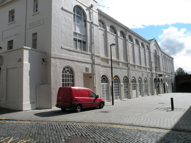
Image: © Keith Edkins Taken: 17 Aug 2017
At one time this was the North East Range of the White Cloth Hall, with Assembly Rooms over. Opened 1777, altered ca. 1865 and 1920. Grade II* listed. Its all-white look seems to be new this year, compare Image
Images are licensed for reuse under creativecommons.org/licenses/by-sa/2.0
Image Location
Latitude
53.795664
Longitude
-1.539372