Frizinghall Road
Introduction
The photograph on this page of Frizinghall Road by Keith Edkins as part of the Geograph project.
The Geograph project started in 2005 with the aim of publishing, organising and preserving representative images for every square kilometre of Great Britain, Ireland and the Isle of Man.

There are currently over 7.5m images from over 14,400 individuals and you can help contribute to the project by visiting https://www.geograph.org.uk
Frizinghall Road
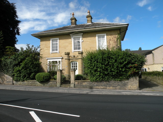
Image: © Keith Edkins Taken: 16 Aug 2017
The Listed Building Register observes that this ca. 1850 villa is "unusual for Bradford in that it is related far more to the seaside type of the period." The crenellated porch is particularly - unusual. Grade II listed.
Images are licensed for reuse under creativecommons.org/licenses/by-sa/2.0
Image Location
Latitude
53.817271
Longitude
-1.770917