Ferry Lane, Winteringham, Lincolnshire
Introduction
The photograph on this page of Ferry Lane, Winteringham, Lincolnshire by Bernard Sharp as part of the Geograph project.
The Geograph project started in 2005 with the aim of publishing, organising and preserving representative images for every square kilometre of Great Britain, Ireland and the Isle of Man.

There are currently over 7.5m images from over 14,400 individuals and you can help contribute to the project by visiting https://www.geograph.org.uk
Ferry Lane, Winteringham, Lincolnshire
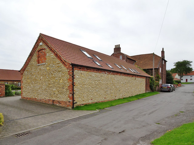
Image: © Bernard Sharp Taken: 14 Aug 2017
On 21 December 2007, North Lincolnshire Council granted planning approval to demolish and partly demolish existing barns and outbuildings and erect four dwelling houses and associated garaging and parking on land at Ferry Lane. Depicted is the barn, immediately north of No.4 Ferry Lane, that has been converted to a dwelling house known as The Stable.
Images are licensed for reuse under creativecommons.org/licenses/by-sa/2.0
Image Location
Latitude
53.688589
Longitude
-0.591223