Home Farm House/Home farm Lodge, Ferringham Lane, Ferring
Introduction
The photograph on this page of Home Farm House/Home farm Lodge, Ferringham Lane, Ferring by Simon Carey as part of the Geograph project.
The Geograph project started in 2005 with the aim of publishing, organising and preserving representative images for every square kilometre of Great Britain, Ireland and the Isle of Man.

There are currently over 7.5m images from over 14,400 individuals and you can help contribute to the project by visiting https://www.geograph.org.uk
Home Farm House/Home farm Lodge, Ferringham Lane, Ferring
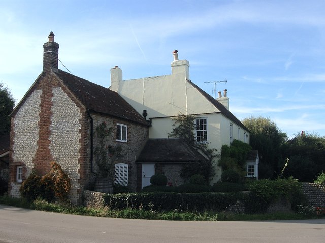
Image: © Simon Carey Taken: 13 Aug 2017
A former 18th century farmhouse that has been converted into two dwellings; Home Farm Lodge is the flint structure to the left and Home Farm House the rest beyond. It ceased being a farmhouse in the 1920s when much of the land to the south of the old village centre was sold for development.
Images are licensed for reuse under creativecommons.org/licenses/by-sa/2.0
Image Location
Latitude
50.812191
Longitude
-0.449407