Barton Road, St Philip's, Bristol 2
Introduction
The photograph on this page of Barton Road, St Philip's, Bristol 2 by David Hallam-Jones as part of the Geograph project.
The Geograph project started in 2005 with the aim of publishing, organising and preserving representative images for every square kilometre of Great Britain, Ireland and the Isle of Man.

There are currently over 7.5m images from over 14,400 individuals and you can help contribute to the project by visiting https://www.geograph.org.uk
Barton Road, St Philip's, Bristol 2
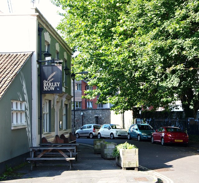
Image: © David Hallam-Jones Taken: 13 Aug 2017
Although in the past there were many pubs in The Ding neighbourhood in the past, “The Barley Mow” (a mow meaning ‘a stack’) is the only one remaining. It dates from the C19th and was previously known as “The Duke of York”. Opposite it is a playing field associated with the Hannah More Primary School.
Images are licensed for reuse under creativecommons.org/licenses/by-sa/2.0
Image Location
Latitude
51.453387
Longitude
-2.577483