Govilon wharf
Introduction
The photograph on this page of Govilon wharf by Philip Pankhurst as part of the Geograph project.
The Geograph project started in 2005 with the aim of publishing, organising and preserving representative images for every square kilometre of Great Britain, Ireland and the Isle of Man.

There are currently over 7.5m images from over 14,400 individuals and you can help contribute to the project by visiting https://www.geograph.org.uk
Govilon wharf
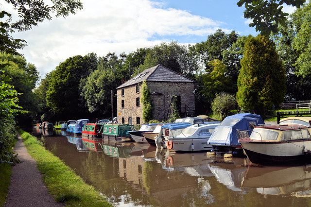
Image: © Philip Pankhurst Taken: 12 Aug 2017
Govilon Wharf was a key point on the Brecknock and Abergavenny canal for the local iron industry and was the terminus for Bailey's Tramroad from Nantyglo Ironworks. The canal as a whole was linked to many tramroads and was important for trade in iron, lime and coal. Although Govilon Wharf lies at the end of the section completed in 1805 under Thomas Cartwright, the warehouse seen here was built after 1821 as Bailey's iron warehouse The Brecknock and Abergavenny Canal (now known as the Monmouthshire and Brecon Canal - 'Mon and Brec') was constructed between 1797 and 1812. Gradually the railway took traffic off the canal and eventually it was bought out by the Great Western Railway. Restoration work began in 1964 and continues, which ambitious plans to reopen to Newport. The warehouse now forms part of the Govilon Boat Club.
Images are licensed for reuse under creativecommons.org/licenses/by-sa/2.0
Image Location
Latitude
51.817258
Longitude
-3.067255