
Albert Road, Bristol 2
Introduction
The photograph on this page of Albert Road, Bristol 2 by David Hallam-Jones as part of the Geograph project.
The Geograph project started in 2005 with the aim of publishing, organising and preserving representative images for every square kilometre of Great Britain, Ireland and the Isle of Man.

There are currently over 7.5m images from over 14,400 individuals and you can help contribute to the project by visiting https://www.geograph.org.uk
Albert Road, Bristol 2
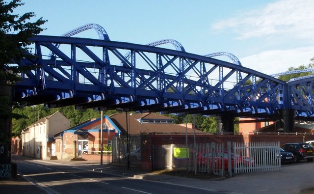
Image: © David Hallam-Jones Taken: 11 Aug 2017
This railway bridge carries trains along a single track towards the "Arriva Train Care Centre" and a small marshalling yard a little further west of here, i.e. to the left of this spot. An oval shaped circuit in this area - known as St Philip's Marsh - allows trains to be brought to the service area from Temple Meads Station in either direction. The building beyond the bridge with blue-painted timberwork is an RSPCA shelter. The "St Philip's Greenway" pedestrian and cycle route also uses this bridge to cross this road - at train track level - on the RSPCA shelter side of the bridge.
Images are licensed for reuse under creativecommons.org/licenses/by-sa/2.0
Image Location

Latitude
51.445566
Longitude
-2.577097