The Manor Arms, North Perrott
Introduction
The photograph on this page of The Manor Arms, North Perrott by Bill Harrison as part of the Geograph project.
The Geograph project started in 2005 with the aim of publishing, organising and preserving representative images for every square kilometre of Great Britain, Ireland and the Isle of Man.

There are currently over 7.5m images from over 14,400 individuals and you can help contribute to the project by visiting https://www.geograph.org.uk
The Manor Arms, North Perrott
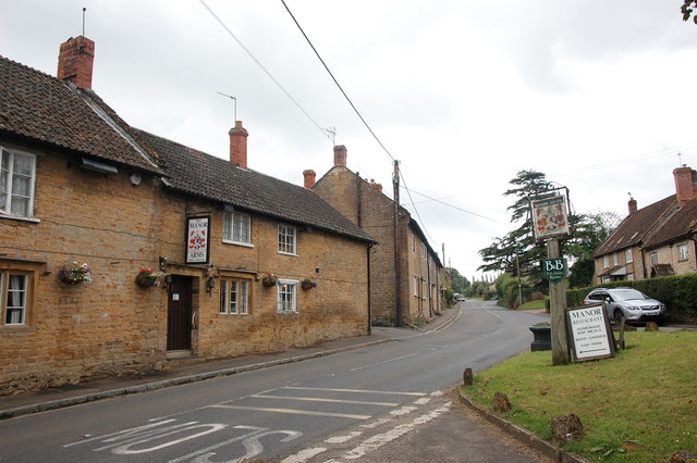
Image: © Bill Harrison Taken: 8 Jul 2016
The 17th Century inn is Grade II listed: http://www.britishlistedbuildings.co.uk/101056850-manor-arms-inn-north-perrott#.WY4LCSaWyAg . The inn sign shows the arms of Hoskins (or Hoskyns): per pale gules and azure, a chevron engrailed or, between three lions rampant argent. The road is the A3066 from Haselbury Plucknett to Brodport.
Images are licensed for reuse under creativecommons.org/licenses/by-sa/2.0
Image Location
Latitude
50.8825
Longitude
-2.748225