Lower Woolbrook farmhouse
Introduction
The photograph on this page of Lower Woolbrook farmhouse by Richard Law as part of the Geograph project.
The Geograph project started in 2005 with the aim of publishing, organising and preserving representative images for every square kilometre of Great Britain, Ireland and the Isle of Man.

There are currently over 7.5m images from over 14,400 individuals and you can help contribute to the project by visiting https://www.geograph.org.uk
Lower Woolbrook farmhouse
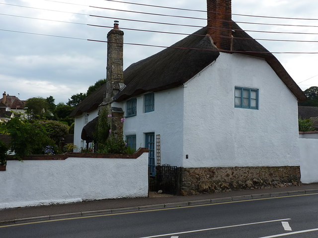
Image: © Richard Law Taken: 19 Jul 2017
A late 17th or early 18th Century farmhouse, given a Grade II listing https://www.britishlistedbuildings.co.uk/101228410-lower-woolbrook-farmhouse-sidmouth#.WYrxnlV96M8 in 1973. All its surrounding lands have long since been given over to housing and urban development.
Images are licensed for reuse under creativecommons.org/licenses/by-sa/2.0
Image Location
Latitude
50.693681
Longitude
-3.240327