High Staples Farm
Introduction
The photograph on this page of High Staples Farm by Oliver Dixon as part of the Geograph project.
The Geograph project started in 2005 with the aim of publishing, organising and preserving representative images for every square kilometre of Great Britain, Ireland and the Isle of Man.

There are currently over 7.5m images from over 14,400 individuals and you can help contribute to the project by visiting https://www.geograph.org.uk
High Staples Farm
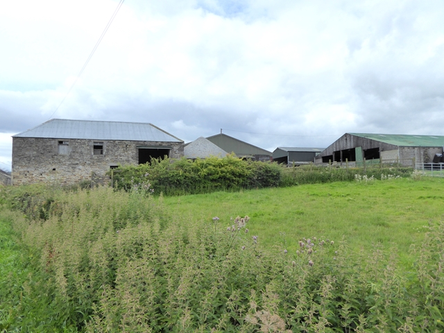
Image: © Oliver Dixon Taken: 6 Aug 2017
The conical roof second from left is that of a circular "gin gang" - a mill driven by horses walking round in a circle. A much better view of the ging gang can be seen in Image
Images are licensed for reuse under creativecommons.org/licenses/by-sa/2.0
Image Location
Latitude
54.915307
Longitude
-2.106045