Bootham
Introduction
The photograph on this page of Bootham by Ian Capper as part of the Geograph project.
The Geograph project started in 2005 with the aim of publishing, organising and preserving representative images for every square kilometre of Great Britain, Ireland and the Isle of Man.

There are currently over 7.5m images from over 14,400 individuals and you can help contribute to the project by visiting https://www.geograph.org.uk
Bootham
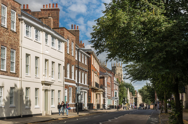
Image: © Ian Capper Taken: 20 Jul 2017
Looking along Bootham with Bootham Bar in the background and the tower of York Minster appearing above the buildings to its left. Most of the buildings are listed, including the nearest, 57 Bootham, built in the 1750s with subsequent alterations which together with a number of other buildings here now forms part of Bootham School. Grade II listed - see www.historicengland.org.uk/listing/the-list/list-entry/1259438.
Images are licensed for reuse under creativecommons.org/licenses/by-sa/2.0
Image Location
Latitude
53.964242
Longitude
-1.087772