Houses at Upper Heaton
Introduction
The photograph on this page of Houses at Upper Heaton by Bobby Clegg as part of the Geograph project.
The Geograph project started in 2005 with the aim of publishing, organising and preserving representative images for every square kilometre of Great Britain, Ireland and the Isle of Man.

There are currently over 7.5m images from over 14,400 individuals and you can help contribute to the project by visiting https://www.geograph.org.uk
Houses at Upper Heaton
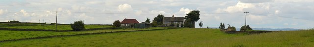
Image: © Bobby Clegg Taken: 18 Sep 2015
These houses stand high up on a ridge above Upper Heaton just to the south of where the B6118 Upper Heaton Lane and New Road converge, offering some excellent views of the Colne and Calder valley landscape, although it must be decidedly rough with a stiff winter westerly blowing. Viewed from the footpath north of Meadow Park in Kirkheaton.
Images are licensed for reuse under creativecommons.org/licenses/by-sa/2.0
Image Location
Latitude
53.666641
Longitude
-1.732232