6,4 and 2 Clifton
Introduction
The photograph on this page of 6,4 and 2 Clifton by Ian Capper as part of the Geograph project.
The Geograph project started in 2005 with the aim of publishing, organising and preserving representative images for every square kilometre of Great Britain, Ireland and the Isle of Man.

There are currently over 7.5m images from over 14,400 individuals and you can help contribute to the project by visiting https://www.geograph.org.uk
6,4 and 2 Clifton
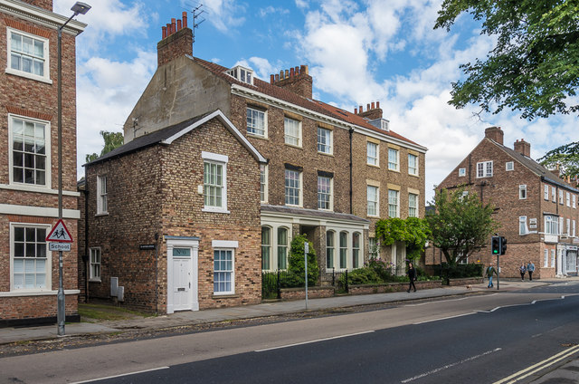
Image: © Ian Capper Taken: 20 Jul 2017
6 Clifton was built in the mid 19th Century and was originally an outbuilding, then a shop, now a house. Behind it is 4 Clifton with 2 Clifton beyond, both built in 1825.. All three buildings are grade II listed - see www.historicengland.org.uk/listing/the-list/list-entry/1259245, www.historicengland.org.uk/listing/the-list/list-entry/1259244 and www.historicengland.org.uk/listing/the-list/list-entry/1259243 respectively.
Images are licensed for reuse under creativecommons.org/licenses/by-sa/2.0
Image Location
Latitude
53.966019
Longitude
-1.090934