Country around Churchill from the air
Introduction
The photograph on this page of Country around Churchill from the air by Derek Harper as part of the Geograph project.
The Geograph project started in 2005 with the aim of publishing, organising and preserving representative images for every square kilometre of Great Britain, Ireland and the Isle of Man.

There are currently over 7.5m images from over 14,400 individuals and you can help contribute to the project by visiting https://www.geograph.org.uk
Country around Churchill from the air
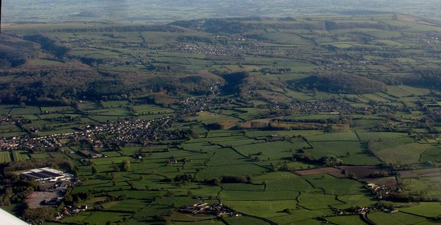
Image: © Derek Harper Taken: 22 Apr 2017
On the left are Lower Langford and the Langford Packhouse of Monaghan Mushrooms. The shaodwed valley amid the wooded hills is Dolebury Bottom; the village beyond it is Shipham, with the crest of the Mendips further away.
Images are licensed for reuse under creativecommons.org/licenses/by-sa/2.0
Image Location
Latitude
51.339075
Longitude
-2.796695