Croxton Kerrial 12thC Medieval Manor House: excavations (6)
Introduction
The photograph on this page of Croxton Kerrial 12thC Medieval Manor House: excavations (6) by Kate Jewell as part of the Geograph project.
The Geograph project started in 2005 with the aim of publishing, organising and preserving representative images for every square kilometre of Great Britain, Ireland and the Isle of Man.

There are currently over 7.5m images from over 14,400 individuals and you can help contribute to the project by visiting https://www.geograph.org.uk
Croxton Kerrial 12thC Medieval Manor House: excavations (6)
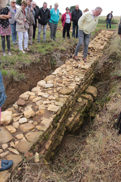
Image: © Kate Jewell Taken: 23 Jul 2017
Drainage channel on the outside of the tithe barn wall. The mystery here is that there is no corresponding structure on the other side of the wall. Our guide suggested that, as there are abundant springs throughout the village, the medieval builders came across a spring here and created this capped drain to take the water away from the barn foundations.
Images are licensed for reuse under creativecommons.org/licenses/by-sa/2.0
Image Location
Latitude
52.855971
Longitude
-0.759724