West Belfast, Peace Wall and Clonard Monastery
Introduction
The photograph on this page of West Belfast, Peace Wall and Clonard Monastery by David Dixon as part of the Geograph project.
The Geograph project started in 2005 with the aim of publishing, organising and preserving representative images for every square kilometre of Great Britain, Ireland and the Isle of Man.

There are currently over 7.5m images from over 14,400 individuals and you can help contribute to the project by visiting https://www.geograph.org.uk
West Belfast, Peace Wall and Clonard Monastery
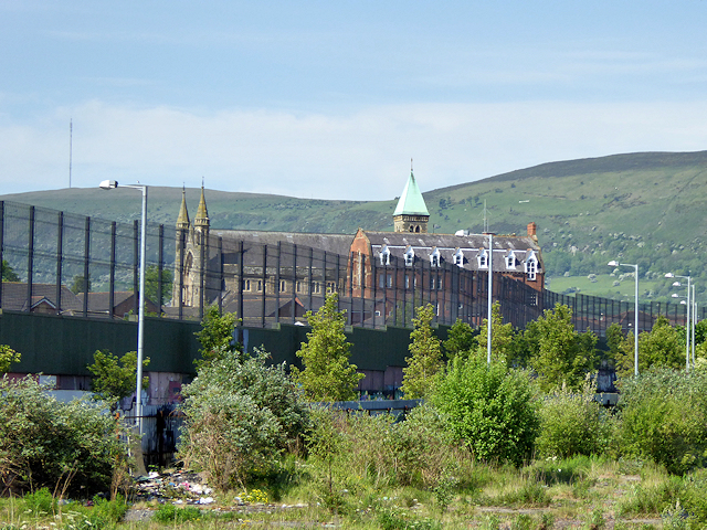
Image: © David Dixon Taken: 26 May 2017
One of the most prominent peace walls separates the nationalist Falls Road and unionist Shankill areas of West Belfast. Almost twenty years after the Good Friday Agreement of 1998 https://en.wikipedia.org/wiki/Good_Friday_Agreement , it is saddening to see this that this huge wall still stretches across the city to divide it. The Northern Ireland Executive has committed to the removal of this and the other peace walls by 2023 (http://www.irishtimes.com/news/robinson-and-mcguinness-want-peace-walls-down-within-10-years-1.1388183 The Irish Times); in the meantime, the wall has become something of a tourist attraction. This view is from the Loyalist side of the wall. The large church on the other side is the Catholic Clonard Monastery, just off the Falls Road.
Images are licensed for reuse under creativecommons.org/licenses/by-sa/2.0
Image Location
Latitude
54.6001
Longitude
-5.956086