View of the railway from Brick Lane bridge
Introduction
The photograph on this page of View of the railway from Brick Lane bridge by Marathon as part of the Geograph project.
The Geograph project started in 2005 with the aim of publishing, organising and preserving representative images for every square kilometre of Great Britain, Ireland and the Isle of Man.

There are currently over 7.5m images from over 14,400 individuals and you can help contribute to the project by visiting https://www.geograph.org.uk
View of the railway from Brick Lane bridge
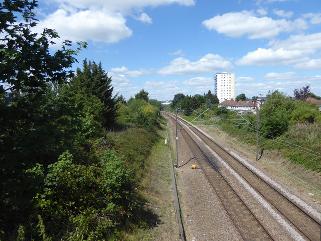
Image: © Marathon Taken: 12 Jul 2017
The line from Edmonton via Lower Edmonton to the centre of Enfield opened on 1st March 1849. The line from Bury Street Junction, north of Edmonton Green, to Cheshunt was opened by the Great Eastern Railway on 1st October 1891 and this is the line seen here. When it was opened the line was known as the Churchbury Loop. The district was still predominantly rural, and the coming of the tram to Waltham Cross in 1904 saw the railway unable to compete. Passenger services ceased on 1st October 1909, but were reinstated for munitions workers between 1st March 1915 and 1st July 1919. After that the line was used only by goods trains until electrified as part of a wider scheme at the start of the 1960s. The line is now known as the Southbury Loop. On 31st May 2015 all services here became part of the London Overground network. This is the view from Brick Lane bridge. The next station in this direction is Turkey Street.
Images are licensed for reuse under creativecommons.org/licenses/by-sa/2.0
Image Location
Latitude
51.658193
Longitude
-0.049861