Wind turbine, Ballyutoag, Belfast (July 2017)
Introduction
The photograph on this page of Wind turbine, Ballyutoag, Belfast (July 2017) by Albert Bridge as part of the Geograph project.
The Geograph project started in 2005 with the aim of publishing, organising and preserving representative images for every square kilometre of Great Britain, Ireland and the Isle of Man.

There are currently over 7.5m images from over 14,400 individuals and you can help contribute to the project by visiting https://www.geograph.org.uk
Wind turbine, Ballyutoag, Belfast (July 2017)
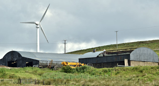
Image: © Albert Bridge Taken: 5 Jul 2017
A wind turbine visible from the Ballyutoag Road and on the satellite photograph. The following information comes from the NI planning portal “Z/2011/0937/F A single wind turbine with tower height of 30m (Amended Plans) Approx 330m South West of 40 Ballyutoag Road Legoniel Belfast.” Approved 19 October 2012.
Images are licensed for reuse under creativecommons.org/licenses/by-sa/2.0
Image Location
Latitude
54.638421
Longitude
-6.007294