River Stour drainage arrangement above Ashen Road bridge
Introduction
The photograph on this page of River Stour drainage arrangement above Ashen Road bridge by Robin Webster as part of the Geograph project.
The Geograph project started in 2005 with the aim of publishing, organising and preserving representative images for every square kilometre of Great Britain, Ireland and the Isle of Man.

There are currently over 7.5m images from over 14,400 individuals and you can help contribute to the project by visiting https://www.geograph.org.uk
River Stour drainage arrangement above Ashen Road bridge
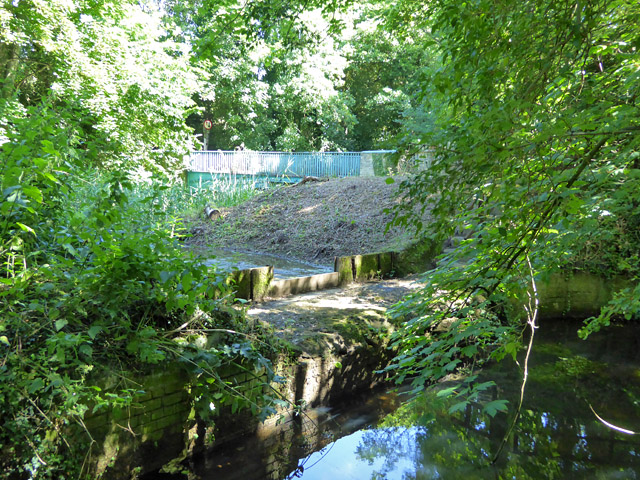
Image: © Robin Webster Taken: 1 Jul 2017
A view from the old railway embankment of a recently cleaned weir between the New Cut on the far side and a slightly repositioned (because of the railway) original course of the River Stour. Beyond is the grade II listed cast-iron bridge dated 1813 carrying Ashen Road over the New Cut. The view is from just about on the Suffolk - Essex border, which follows the original course of the river. The New Cut was made as a mill stream, but for most of its length takes the usual main flow of the river now. It is not too clear in which direction water flows over the weir when levels are higher, but probably from the near side to the far side - there is no provision for downstream scour on the near side.
Images are licensed for reuse under creativecommons.org/licenses/by-sa/2.0
Image Location
Latitude
52.073979
Longitude
0.577756