Jamaica Street
Introduction
The photograph on this page of Jamaica Street by Ian Capper as part of the Geograph project.
The Geograph project started in 2005 with the aim of publishing, organising and preserving representative images for every square kilometre of Great Britain, Ireland and the Isle of Man.

There are currently over 7.5m images from over 14,400 individuals and you can help contribute to the project by visiting https://www.geograph.org.uk
Jamaica Street
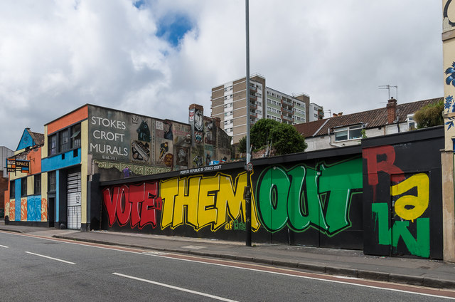
Image: © Ian Capper Taken: 25 Jun 2017
Street art in Jamaica Street, with the headquarters of the People's Republic of Stokes Croft in beyond. The PRSC was founded in 2007 as a community group aiming to preserve the unique character of what was a run down area just north of the commercial centre of Bristol, promoting street art and other cultural media, as well as direct and other political action. This particular work on hoardings in front of a vacant site, what the PRSC describe as their outdoor gallery, was created in the run up to the June 2017 general election, with the colours of the three main opposition parties - red for Labour, yellow for the Liberal Democrats and green for the Greens, giving a clear political message.
Images are licensed for reuse under creativecommons.org/licenses/by-sa/2.0
Image Location


Leaflet Map data © OpenStreetMap
Latitude
51.462493
Longitude
-2.590712