Annetwell Street/Abbey Street, June 2017
Introduction
The photograph on this page of Annetwell Street/Abbey Street, June 2017 by The Carlisle Kid as part of the Geograph project.
The Geograph project started in 2005 with the aim of publishing, organising and preserving representative images for every square kilometre of Great Britain, Ireland and the Isle of Man.

There are currently over 7.5m images from over 14,400 individuals and you can help contribute to the project by visiting https://www.geograph.org.uk
Annetwell Street/Abbey Street, June 2017
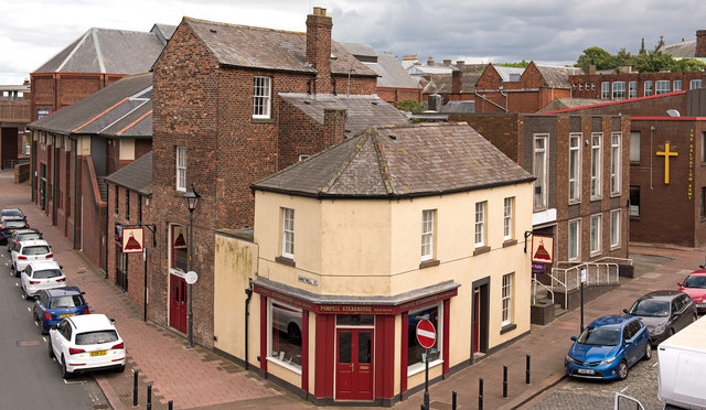
Image: © The Carlisle Kid Taken: 25 Jun 2017
Annetwell Street, on the left in this view, has been largely obliterated - the entire north side was lost 1972-3 to make way for Castle Way, the inner ring-road scheme. Only the yellow painted building and its immediate neighbour survive from the early 19th Century - beyond that are the modern studios of BBC Cumbria and beyond that a modern extension to the Tullie House Museum. Photograph is for record only - I have no connection with any business seen in this view and cannot advise on their products or services.
Images are licensed for reuse under creativecommons.org/licenses/by-sa/2.0
Image Location
Latitude
54.895525
Longitude
-2.942036