New Mill Gill at Gawthorpe
Introduction
The photograph on this page of New Mill Gill at Gawthorpe by John Davies as part of the Geograph project.
The Geograph project started in 2005 with the aim of publishing, organising and preserving representative images for every square kilometre of Great Britain, Ireland and the Isle of Man.

There are currently over 7.5m images from over 14,400 individuals and you can help contribute to the project by visiting https://www.geograph.org.uk
New Mill Gill at Gawthorpe
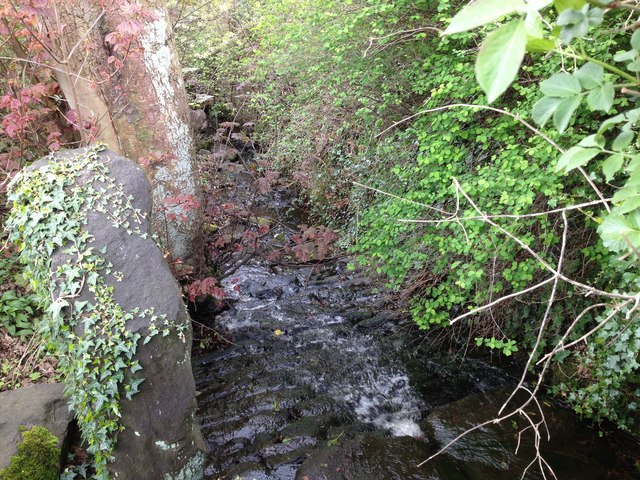
Image: © John Davies Taken: 17 Apr 2017
From a culvert beneath Gawthorpe Lane, the beck reappears to flow down over these sets. The large upright slab to the left looks like one side of a gap stile. This is one of the few places where the beck's flow seems to be controlled in any way. Where the culvert emerges, it appears as if there is an older structure upon which the more modern one has been constructed.
Images are licensed for reuse under creativecommons.org/licenses/by-sa/2.0
Image Location
Latitude
53.855933
Longitude
-1.833797