Towne Gate, Heddon on the Wall
Introduction
The photograph on this page of Towne Gate, Heddon on the Wall by Andrew Curtis as part of the Geograph project.
The Geograph project started in 2005 with the aim of publishing, organising and preserving representative images for every square kilometre of Great Britain, Ireland and the Isle of Man.

There are currently over 7.5m images from over 14,400 individuals and you can help contribute to the project by visiting https://www.geograph.org.uk
Towne Gate, Heddon on the Wall
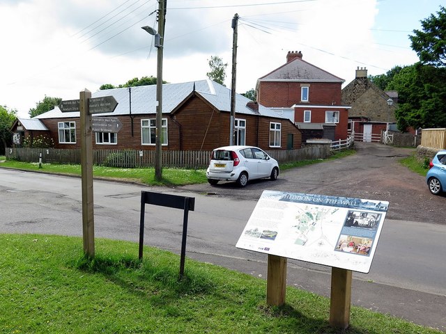
Image: © Andrew Curtis Taken: 9 Jun 2017
The location shown is where Hadrian's Wall Path (National Trail) going from east to west turns from Towne Gate, the road through the village, onto the path of Chare Bank (ahead) which follows part of the ditch line of the Roman Vallum. The finger post on the left points out the trail direction as well as a short detour (right) towards the preserved section of the Roman Wall on the east side of Heddon village. The route of the trail through the village has recently (2017) been augmented by three large information boards which show a suitably oriented map and some historical information. The board here points out the Roman Wall and the Women's Institute which was the first in Northumberland, founded in 1917. Their hut 9opposite) was built in 1922 Image
Images are licensed for reuse under creativecommons.org/licenses/by-sa/2.0
Image Location
Latitude
54.996409
Longitude
-1.79036