West end of Healey Lane, Bingley
Introduction
The photograph on this page of West end of Healey Lane, Bingley by Stephen Craven as part of the Geograph project.
The Geograph project started in 2005 with the aim of publishing, organising and preserving representative images for every square kilometre of Great Britain, Ireland and the Isle of Man.

There are currently over 7.5m images from over 14,400 individuals and you can help contribute to the project by visiting https://www.geograph.org.uk
West end of Healey Lane, Bingley
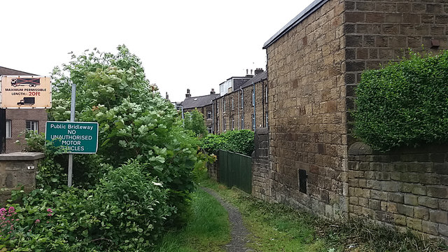
Image: © Stephen Craven Taken: 6 Jun 2017
The "lane" is shown on some maps as if it is a road, but in fact it is only of bridleway status, as indicated on this old sign. The warning "no unauthorised motor vehicles" is redundant, since this end is now so overgrown that you would have a job getting anything more than a mountain bike along this section. After the first 50 metres or so, it does become more accessible.
Images are licensed for reuse under creativecommons.org/licenses/by-sa/2.0
Image Location
Latitude
53.845328
Longitude
-1.834751