Octagonal cottage at Teddesley Home Farm
Introduction
The photograph on this page of Octagonal cottage at Teddesley Home Farm by Richard Law as part of the Geograph project.
The Geograph project started in 2005 with the aim of publishing, organising and preserving representative images for every square kilometre of Great Britain, Ireland and the Isle of Man.

There are currently over 7.5m images from over 14,400 individuals and you can help contribute to the project by visiting https://www.geograph.org.uk
Octagonal cottage at Teddesley Home Farm
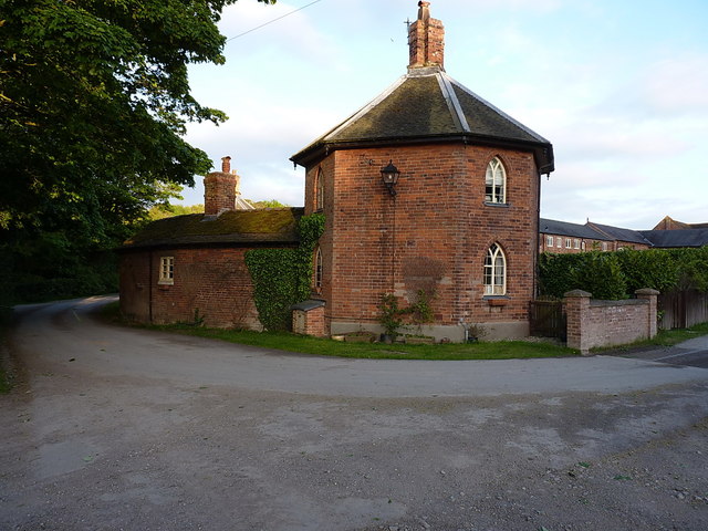
Image: © Richard Law Taken: 4 May 2017
One of a pair of identical octagonal cottages (the other is around to the left) which are linked together by the former poultry house, and date from the early 1830s. Collectively they have a Grade II listing https://www.britishlistedbuildings.co.uk/101374103-former-poultry-house-and-attached-pair-of-cottages-approximately-100-yards-north-west-of-teddesley-home-farmhouse-teddesley-hay#.WSXk19QrLGg which was granted in 1986.
Images are licensed for reuse under creativecommons.org/licenses/by-sa/2.0
Image Location
Latitude
52.743222
Longitude
-2.07328