Mill Pond on Shenfield Common
Introduction
The photograph on this page of Mill Pond on Shenfield Common by Marathon as part of the Geograph project.
The Geograph project started in 2005 with the aim of publishing, organising and preserving representative images for every square kilometre of Great Britain, Ireland and the Isle of Man.

There are currently over 7.5m images from over 14,400 individuals and you can help contribute to the project by visiting https://www.geograph.org.uk
Mill Pond on Shenfield Common
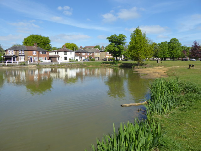
Image: © Marathon Taken: 10 May 2017
William the Conqueror apparently allocated the land where Shenfield Common is located to Geffery de Mandeville. Records in the Domesday Book give the area the name Chenefield, a Saxon name meaning 'good lands'. There have been a variety of owners since that time and in the mid-19th century, various areas were sold off. Sections of the woodland were then cleared for pasture and the pond was used for milling purposes. The arrival of the railway in the 1840's resulted in big landscape changes on the Common with excavated soil being deposited on the land. In 1881, commoner's rights over the common were extinguished so that the site could be made into a public park. Shenfield Common is managed by the Shenfield Common Conservators and the common is now largely wooded. There are two ponds on the common. The first pond, seen here, is set within the formal grassland and is known as Mill Pond. The second pond is situated further into the woodland area.
Images are licensed for reuse under creativecommons.org/licenses/by-sa/2.0
Image Location
Latitude
51.617317
Longitude
0.309669