War Memorial, Steventon
Introduction
The photograph on this page of War Memorial, Steventon by Chris Brown as part of the Geograph project.
The Geograph project started in 2005 with the aim of publishing, organising and preserving representative images for every square kilometre of Great Britain, Ireland and the Isle of Man.

There are currently over 7.5m images from over 14,400 individuals and you can help contribute to the project by visiting https://www.geograph.org.uk
War Memorial, Steventon
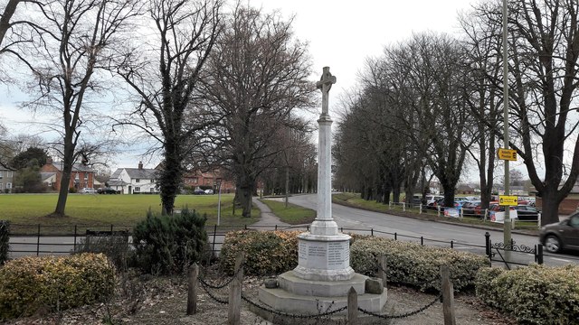
Image: © Chris Brown Taken: 19 Feb 2017
Only by designating the war memorial as primary subject is this image made a Geograph; most of the background is the green in SU4792. It shows the stately avenue along the highway towards Abingdon and Oxford, cutting across the green and the older east-west pattern of the village, which for some 50 years was the A34 road.
Images are licensed for reuse under creativecommons.org/licenses/by-sa/2.0
Image Location
Latitude
51.624673
Longitude
-1.320716