Foel Rhiwlas from near Hafod
Introduction
The photograph on this page of Foel Rhiwlas from near Hafod by John Haynes as part of the Geograph project.
The Geograph project started in 2005 with the aim of publishing, organising and preserving representative images for every square kilometre of Great Britain, Ireland and the Isle of Man.

There are currently over 7.5m images from over 14,400 individuals and you can help contribute to the project by visiting https://www.geograph.org.uk
Foel Rhiwlas from near Hafod
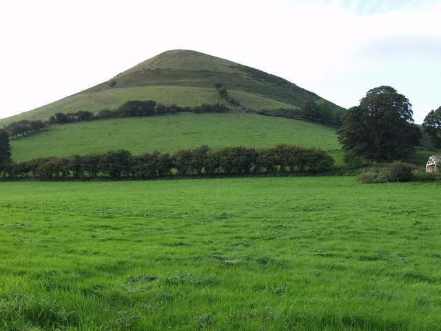
Image: © John Haynes Taken: 28 Aug 2007
The change in the grazings as you go up the hill is very clear here from the intensive grass in the foreground, more extensive grazing up the slope with good hedges, then onto upland grass and finally onto the open hill with bracken and whins.
Images are licensed for reuse under creativecommons.org/licenses/by-sa/2.0
Image Location
Latitude
52.88383
Longitude
-3.187932