Wind turbine, Ballyhowne near Ballyclare (May 2017)
Introduction
The photograph on this page of Wind turbine, Ballyhowne near Ballyclare (May 2017) by Albert Bridge as part of the Geograph project.
The Geograph project started in 2005 with the aim of publishing, organising and preserving representative images for every square kilometre of Great Britain, Ireland and the Isle of Man.

There are currently over 7.5m images from over 14,400 individuals and you can help contribute to the project by visiting https://www.geograph.org.uk
Wind turbine, Ballyhowne near Ballyclare (May 2017)
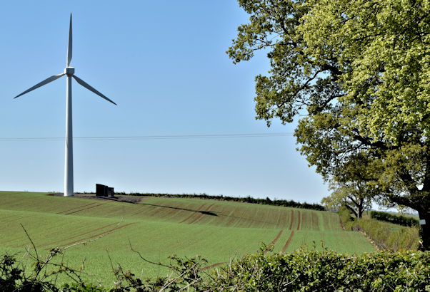
Image: © Albert Bridge Taken: 7 May 2017
A wind turbine close to the Ballyrobert Road. The following information comes from the NI Planning Portal “U/2010/0312/F Erection of single 250kW wind turbine of 32m tower height (47m to tip) 350m South West of 191 Ballyrobert Road Ballyclare Co. Antrim BT39 9RJ” (approved 22 June 2011).
Images are licensed for reuse under creativecommons.org/licenses/by-sa/2.0
Image Location
Latitude
54.730006
Longitude
-6.014599