Katharine Well
Introduction
The photograph on this page of Katharine Well by Tiger as part of the Geograph project.
The Geograph project started in 2005 with the aim of publishing, organising and preserving representative images for every square kilometre of Great Britain, Ireland and the Isle of Man.

There are currently over 7.5m images from over 14,400 individuals and you can help contribute to the project by visiting https://www.geograph.org.uk
Katharine Well
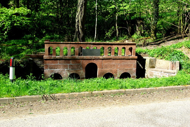
Image: © Tiger Taken: 5 May 2017
"This well was built in memory of Katharine Losh of Woodside Wreay for the watering of horses which used the road Restored by members of the parish 1970 1866 KATHARINE WELL" Katharine, who died in 1835, was the sister of Image, architect of St Mary's Church at Wreay. For a close-up of the inscriptions see Image
Images are licensed for reuse under creativecommons.org/licenses/by-sa/2.0
Image Location
Latitude
54.807003
Longitude
-2.870118