Penwortham Bridge
Introduction
The photograph on this page of Penwortham Bridge by Nick Harling as part of the Geograph project.
The Geograph project started in 2005 with the aim of publishing, organising and preserving representative images for every square kilometre of Great Britain, Ireland and the Isle of Man.

There are currently over 7.5m images from over 14,400 individuals and you can help contribute to the project by visiting https://www.geograph.org.uk
Penwortham Bridge
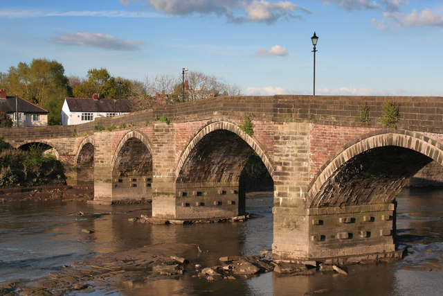
Image: © Nick Harling Taken: 1 May 2017
A closer look at the bridge described in Image Of particular note are the different types of stone used in the various elements of construction; also the unusual protruding blocks on the piers.
Images are licensed for reuse under creativecommons.org/licenses/by-sa/2.0
Image Location
Latitude
53.74876
Longitude
-2.714042