River Thames: Kew Bridge
Introduction
The photograph on this page of River Thames: Kew Bridge by Nigel Cox as part of the Geograph project.
The Geograph project started in 2005 with the aim of publishing, organising and preserving representative images for every square kilometre of Great Britain, Ireland and the Isle of Man.

There are currently over 7.5m images from over 14,400 individuals and you can help contribute to the project by visiting https://www.geograph.org.uk
River Thames: Kew Bridge
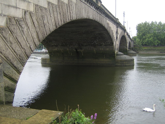
Image: © Nigel Cox Taken: 22 Aug 2007
By virtue of the way in which the location of the OS Grid was determined, Kew Bridge is something of an oddity, because this upstream face on the west side is in this square but the downstream or eastern face is in the adjacent grid square Image & Image The OS 519000 metre Easting runs down the middle of the bridge. The first bridge at this location was built of wood in 1759 and replaced a horse powered ferry. The power of the currents in the Thames started to damage the wooden piers so the bridge was replaced by a stone structure designed by James Paine thirty years later in 1789. The new bridge was opened by King George III. In 1873 ownership of the bridge passed to the Metropolitan Board of Works and tolls were abolished. The bridge was later transferred to the Middlesex and Surrey County Councils. The present bridge, the third to occupy this site, was designed by Sir John Wolfe-Barry and CA Breton and opened by King Edward VII in 1903. The bridge was renamed the King Edward VII Bridge to commemorate this, but this name proved unpopular and it reverted to Kew Bridge a few years later. (Information from the Port of London Authority website here http://www.portoflondon.co.uk/display_fixedpage.cfm/id/215 )
Images are licensed for reuse under creativecommons.org/licenses/by-sa/2.0
Image Location


Leaflet Map data © OpenStreetMap
Latitude
51.48666
Longitude
-0.288943