A40 at Birdwood
Introduction
The photograph on this page of A40 at Birdwood by Pauline E as part of the Geograph project.
The Geograph project started in 2005 with the aim of publishing, organising and preserving representative images for every square kilometre of Great Britain, Ireland and the Isle of Man.

There are currently over 7.5m images from over 14,400 individuals and you can help contribute to the project by visiting https://www.geograph.org.uk
A40 at Birdwood
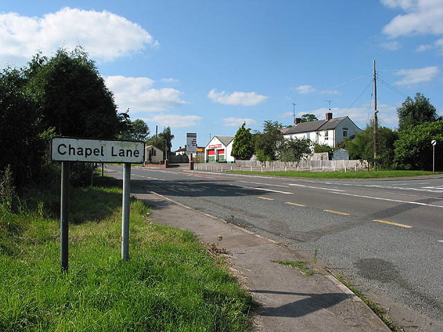
Image: © Pauline E Taken: 26 Aug 2007
Bulley Lane goes off to the right. Birdwood Garage is in the centre of the picture, with the old corrugated Mission Church on its left. There's also a speed camera a short way past the bushes on the left. Taken from the Chapel Lane/A40 junction.
Images are licensed for reuse under creativecommons.org/licenses/by-sa/2.0
Image Location
Latitude
51.866726
Longitude
-2.3761