Old Milestone, A1, High Street, Stotford
Introduction
The photograph on this page of Old Milestone, A1, High Street, Stotford by Robin Hall as part of the Geograph project.
The Geograph project started in 2005 with the aim of publishing, organising and preserving representative images for every square kilometre of Great Britain, Ireland and the Isle of Man.

There are currently over 7.5m images from over 14,400 individuals and you can help contribute to the project by visiting https://www.geograph.org.uk
Old Milestone, A1, High Street, Stotford
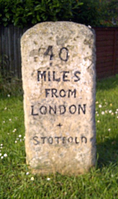
Image: © Robin Hall Taken: Unknown
The milestone is located by No. 29, High Street, 160m south of the junction with Regent Street, on the grass verge, on the east side of road - originally on the west side of the road. Parish of Stotford (Mid Bedfordshire District). Carved stone post, erected by the Stevenage & Biggleswade turnpike trust in the 19th century. Inscription reads:- 40 / MILES / FROM / LONDON / + / STOTFORD Milestone Society National ID: BD_LY40
Images are licensed for reuse under creativecommons.org/licenses/by-sa/2.0
Image Location
Latitude
52.015199
Longitude
-0.230351