River Thames at Isleworth Ait
Introduction
The photograph on this page of River Thames at Isleworth Ait by Nigel Cox as part of the Geograph project.
The Geograph project started in 2005 with the aim of publishing, organising and preserving representative images for every square kilometre of Great Britain, Ireland and the Isle of Man.

There are currently over 7.5m images from over 14,400 individuals and you can help contribute to the project by visiting https://www.geograph.org.uk
River Thames at Isleworth Ait
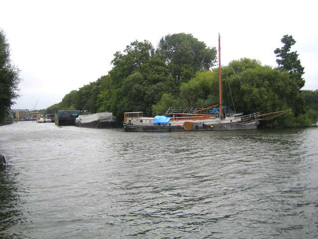
Image: © Nigel Cox Taken: 22 Aug 2007
Isleworth Ait is one of several islands in this reach of the River Thames. The 3.5 hectare island is uninhabited and only accessible by boat. It is a Local Nature Reserve (LNR) managed by the London Wildlife Trust, and their website page describing the island and its natural habitat is here http://www.wildlondon.org.uk/reserve.php?reserve_id=95 The whole of the island is contained within this grid square, and this is the southern or upstream tip. The "paddle" on the side of the boat moored on the island is a leeboard, which is a type of keel that can be lowered into the water to provide sideways stability whilst the vessel is under away.
Images are licensed for reuse under creativecommons.org/licenses/by-sa/2.0
Image Location
Latitude
51.465548
Longitude
-0.321405