Knutsford Road swing bridge, Manchester Ship Canal
Introduction
The photograph on this page of Knutsford Road swing bridge, Manchester Ship Canal by S Parish as part of the Geograph project.
The Geograph project started in 2005 with the aim of publishing, organising and preserving representative images for every square kilometre of Great Britain, Ireland and the Isle of Man.

There are currently over 7.5m images from over 14,400 individuals and you can help contribute to the project by visiting https://www.geograph.org.uk
Knutsford Road swing bridge, Manchester Ship Canal
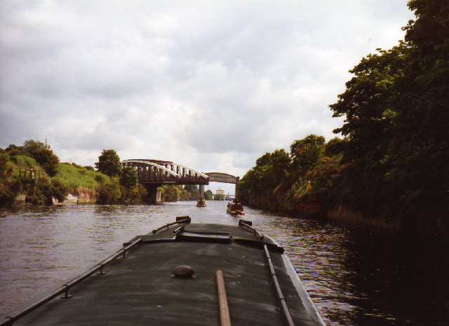
Image: © S Parish Taken: Unknown
The left (north) bank of the Canal is in square SJ6287. The bridge is not swinging for the narrowboats but for the oil tanker leaving Latchford locks and heading west under the disused railway bridge.
Images are licensed for reuse under creativecommons.org/licenses/by-sa/2.0
Image Location


Leaflet Map data © OpenStreetMap
Latitude
53.374018
Longitude
-2.565114