Old School House, beside Mullabrack Parish Church
Introduction
The photograph on this page of Old School House, beside Mullabrack Parish Church by P Flannagan as part of the Geograph project.
The Geograph project started in 2005 with the aim of publishing, organising and preserving representative images for every square kilometre of Great Britain, Ireland and the Isle of Man.

There are currently over 7.5m images from over 14,400 individuals and you can help contribute to the project by visiting https://www.geograph.org.uk
Old School House, beside Mullabrack Parish Church
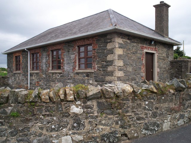
Image: © P Flannagan Taken: 25 Aug 2007
This was the primary school with the infant school nearby. Thought to date from 1821, both schools were closed in 1986 and the pupils transferred to the new school at Hamiltonsbawn. The building now serves the church as a hall. See Image and Image
Images are licensed for reuse under creativecommons.org/licenses/by-sa/2.0
Image Location
Latitude
54.320742
Longitude
-6.528808