Castle Street, Dumbarton
Introduction
The photograph on this page of Castle Street, Dumbarton by Lairich Rig as part of the Geograph project.
The Geograph project started in 2005 with the aim of publishing, organising and preserving representative images for every square kilometre of Great Britain, Ireland and the Isle of Man.

There are currently over 7.5m images from over 14,400 individuals and you can help contribute to the project by visiting https://www.geograph.org.uk
Castle Street, Dumbarton
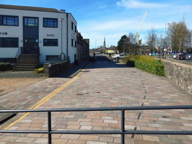
Image: © Lairich Rig Taken: 26 Mar 2017
Part of the Denny Tank Museum is on the left. Compare a view in the opposite direction, looking back towards this point: Image In that picture, a section of road (then only recently built) curves to the left, but the street carries on directly ahead, to end at the point from which the present photograph was taken. The steeple directly ahead is that of Dumbarton Parish Church (compare Image, taken from further ahead). The crane on the right is on the former site of the Burgh Hall: Image
Images are licensed for reuse under creativecommons.org/licenses/by-sa/2.0
Image Location
Latitude
55.943492
Longitude
-4.563348