Dame Helen's Castle View
Introduction
The photograph on this page of Dame Helen's Castle View by Mary and Angus Hogg as part of the Geograph project.
The Geograph project started in 2005 with the aim of publishing, organising and preserving representative images for every square kilometre of Great Britain, Ireland and the Isle of Man.

There are currently over 7.5m images from over 14,400 individuals and you can help contribute to the project by visiting https://www.geograph.org.uk
Dame Helen's Castle View
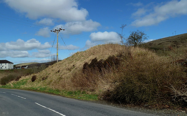
Image: © Mary and Angus Hogg Taken: 2 Apr 2017
This overgrown mound, high above the Muck Water, is known as Dame Helen’s Castle. Surveys showed that the site was a motte & bailey with an old building on top and an outer defensive ditch. Much has been lost from road construction and the use of material for house-building. The name “Dalmellington” comes from “Dame Helen’s Toun”.
Images are licensed for reuse under creativecommons.org/licenses/by-sa/2.0
Image Location
Latitude
55.321163
Longitude
-4.388865