Brighouse Viaduct
Introduction
The photograph on this page of Brighouse Viaduct by Bobby Clegg as part of the Geograph project.
The Geograph project started in 2005 with the aim of publishing, organising and preserving representative images for every square kilometre of Great Britain, Ireland and the Isle of Man.

There are currently over 7.5m images from over 14,400 individuals and you can help contribute to the project by visiting https://www.geograph.org.uk
Brighouse Viaduct
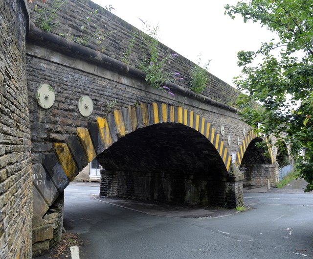
Image: © Bobby Clegg Taken: 26 Aug 2015
Viewed from Cliffe Road towards the A643 Bridge End. The very low arched viaduct appears to be held together by tie bars and pattress plates visible between the arch voussoirs and the string course above. The bridge ref. is MVN2/171 which translates as Manchester Victoria Normanton Section 2 Bridge 171.
Images are licensed for reuse under creativecommons.org/licenses/by-sa/2.0
Image Location
Latitude
53.698832
Longitude
-1.783374