Harmston: aerial 2017
Introduction
The photograph on this page of Harmston: aerial 2017 by Chris as part of the Geograph project.
The Geograph project started in 2005 with the aim of publishing, organising and preserving representative images for every square kilometre of Great Britain, Ireland and the Isle of Man.

There are currently over 7.5m images from over 14,400 individuals and you can help contribute to the project by visiting https://www.geograph.org.uk
Harmston: aerial 2017
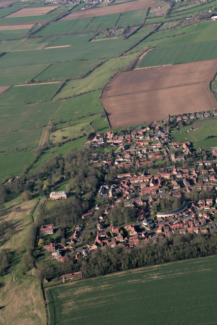
Image: © Chris Taken: 25 Mar 2017
Though most of the village is in this square, my eye is always drawn by the crescent-shaped building, in the next square, for which see also Image Village is on "the Cliff" - picture shows the slope down on to the plain below.
Images are licensed for reuse under creativecommons.org/licenses/by-sa/2.0
Image Location
Latitude
53.146361
Longitude
-0.546978