Eroding glacial deposits, Afon Ogwen
Introduction
The photograph on this page of Eroding glacial deposits, Afon Ogwen by Jonathan Wilkins as part of the Geograph project.
The Geograph project started in 2005 with the aim of publishing, organising and preserving representative images for every square kilometre of Great Britain, Ireland and the Isle of Man.

There are currently over 7.5m images from over 14,400 individuals and you can help contribute to the project by visiting https://www.geograph.org.uk
Eroding glacial deposits, Afon Ogwen
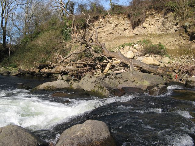
Image: © Jonathan Wilkins Taken: 25 Mar 2017
At this point the Afon Ogwen has been engineered to make a slight drop, but it is not obvious whether that is the cause of the erosion of the thick glacial deposits which make a cliff here. I suspect that the cliff is actually a section across a drumlin running parallel to the Menai Strait which constrained the flow of ice during the last glacial maximum. A fantastic scene, with a dead tree obviously stranded during a flood in recent years. It is not obvious from the image that there are houses at the top of the bank.
Images are licensed for reuse under creativecommons.org/licenses/by-sa/2.0
Image Location
Latitude
53.210613
Longitude
-4.094264