The Terrace, Richmond Hill, seen from Petersham Meadows
Introduction
The photograph on this page of The Terrace, Richmond Hill, seen from Petersham Meadows by Stefan Czapski as part of the Geograph project.
The Geograph project started in 2005 with the aim of publishing, organising and preserving representative images for every square kilometre of Great Britain, Ireland and the Isle of Man.

There are currently over 7.5m images from over 14,400 individuals and you can help contribute to the project by visiting https://www.geograph.org.uk
The Terrace, Richmond Hill, seen from Petersham Meadows
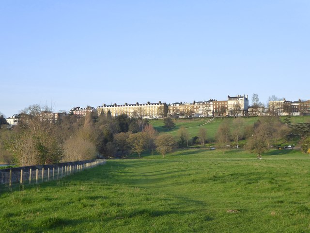
Image: © Stefan Czapski Taken: 24 Mar 2017
Seen from close to the point where River Lane reaches the Thames towpath. The season is early spring, with trees just coming into leaf. The Meadows are in the hands of the National Trust. There always used to be cattle grazing here (at least in the warmer months) but I haven't noticed the herd in the last few years.
Images are licensed for reuse under creativecommons.org/licenses/by-sa/2.0
Image Location
Latitude
51.453087
Longitude
-0.299122