The Bridgeyate Ebenezer
Introduction
The photograph on this page of The Bridgeyate Ebenezer by Neil Owen as part of the Geograph project.
The Geograph project started in 2005 with the aim of publishing, organising and preserving representative images for every square kilometre of Great Britain, Ireland and the Isle of Man.

There are currently over 7.5m images from over 14,400 individuals and you can help contribute to the project by visiting https://www.geograph.org.uk
The Bridgeyate Ebenezer
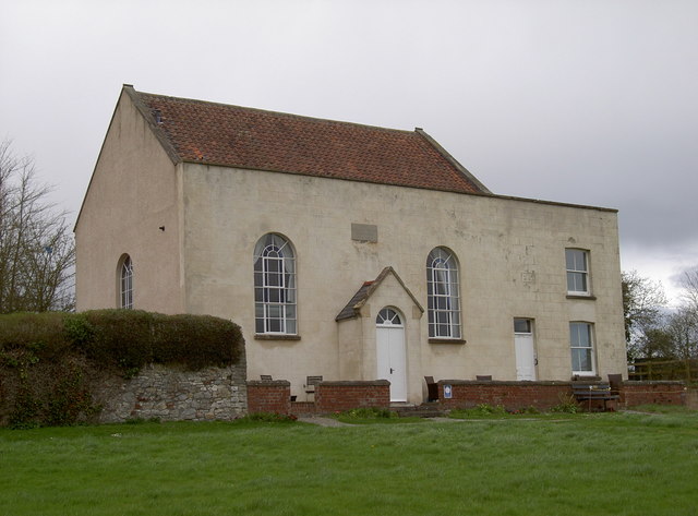
Image: © Neil Owen Taken: 21 Mar 2017
A United Methodist chapel was established here in 1810 to serve the villagers. Many local people had to gather in houses before plans were made to build a permanent structure; one John Trubody gave a small plot of land for the foundation in February, 1810, here in Bridgeyate. The worshippers, many of whom worked at the Warmley Tower brassworks, established this homely chapel. Local tales state that John Wesley himself came here from Kingswood to preach on the Common, tying his horse to the chestnut tree nearby. Now, however, the Grade II listed church has been converted into up-market holiday flats, using the old chapel and schoolhouse.
Images are licensed for reuse under creativecommons.org/licenses/by-sa/2.0
Image Location
Latitude
51.457595
Longitude
-2.459658